Tenna to Piz Fess area

Piz Signina general area

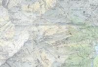
Tenna and surroundings, wanderung map

The fireplace in Trin-Mulin

From Trin-Mulin at dawn, 06:36

The Oberhorn is the peak on the left

08:29
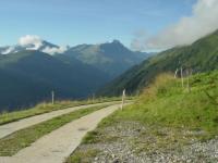
At the highest point we could drive, ready to go

Pedro, Marco and Ariana

Gaston, Pedro and Marco, 08:30

Tenna in the back, 08:37
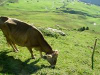
Good place for cow-tipping, 09:09

Taellibach schlucht, 09:29

09:29

10:00

First break, 10:00

10:43
10:43

11:02

11:18

Second break, 11:31
Gaston has to stay behind because of blisters, 11:42

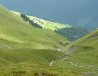
Trin-Mulin and Trin-Dig in the back and Gaston as a tiny speck, 11:58

11:58

12:18

12:20

12:20

At the beginning of the Schneeboda, 12:31

12:32

12:47

The final part is a walk in the park, 12:47

12:47

13:18

13:18
finally at the top, 13:20

13:20

Wild flowers near the top, 13:21

13:22

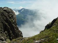
A very steep drop-off, 13:22

13:23

13:23

13:24

13:24

Ariana celebrating at the top, 13:24

13:24

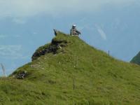
That is the real Piz Fess, nobody wants to climb it, it is separated from the hiking path by a cliff, 13:25

13:25

13:25

13:27

13:27

13:27

13:27

13:28

13:28

13:28

13:29

Ariana, Marco and Pedro at the top, 13:32

13:33

13:33

The mountain log book with our entries, 13:41

break on the way down, 15:18

15:41

After a snack at the Alpenblick, Tenna, 17:34